
Native Title Vision
Visualising native title matters
Native Title Vision (NTV) is a free online visualisation, mapping and query tool. All that is needed to use NTV is a computer connected to the internet, and a current web browser. NTV puts you in the driver's seat in exploring native title and brings together:
- a geospatial view of the Registers and databases
- overlays of administrative regions, non-freehold land parcels and resources tenure.
For queries directly related to NTV contact: geoservices@nntt.gov.au
Getting access to NTV
The NNTT is pleased to announce that NTV has been updated for 2025 with a new version. RNTBCs have now been added as a layer in each of the state applications. One of the exciting new features is that you can now dock your information popup out of the way of the feature you are looking at. Other enhancements include faster speed and a more streamlined modern interface.
You can download an updated Quick Start Guide for NTV: NTV Quick Start Guide (pdf, 1.3 mb)
Choose your state or territory of interest by selecting from one of the maps below:
 National Overview |  New South Wales |  Northern Territory |
 Queensland |  South Australia |  Victoria and Tasmania |
 Western Australia | 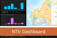 NTV Dashboard |  Applications - historical |
NTV RNTBCs and Future Acts
Use this app to discover future act matters that intersect with an RNTBC or PBC. Results can be exported to CSV for further use in a spreadsheet.
NTV Apps, Maps and Web Services
NTV apps, maps, and ESRI REST web map services can all be accessed from a single location:
Disclaimer
Prepared by the National Native Title Tribunal (NNTT) © Commonwealth of Australia, 2026. The NNTT reserves all rights in relation to the use of the logo and artwork, however reproductions of the information contained is permitted and is to be attributed to the NNTT.
Reasonable Care has been taken in the preparation of this material to ensure that the information is accurate at the time of publication. However, the information is provided for general information purposes only and does not constitute legal advice. No liability is accepted by the NNTT, the Native Title Registrar or the Commonwealth for any loss or damage arising from reliance on the information contained in this material. Before acting on any information, you should obtain independent legal advice to ensure you understand how the law applies to your circumstances.
Western Australian information:
Western Australian Land Information Authority (‘Landgate’) information contained on this website is for personal and non-commercial use and is to be used as a guide only. Use for commercial advantage or monetary compensation is strictly prohibited.
Landgate takes no responsibility as to the reliability, currency or accuracy of Landgate data contained on this website or any output derived from that data. Landgate source data can be purchased directly from Landgate if required.
Administrative Boundary data, Crown Reserve data and Cadastral data © 2026 Western Australian Land Information Authority.
Location information data licensed from Western Australian Land Information Authority (WALIA) trading as Landgate. Copyright in the location information data remains with WALIA. WALIA does not warrant the accuracy or completeness of the location information data or its suitability for any particular purpose.